About Western Migrations
Migration is a complex behavior that involves the seasonal movement between distinct home ranges, which allows individuals to track seasonally favorable forage conditions or to avoid predation and other threats. However, for many species, the difficult migratory journeys are being negatively impacted by roads, fences, and other human developments. These obstacles impede and threaten the long-term persistence of many ungulate herds that rely on migration. Recognizing both the importance of ungulate migration as well as the many threats, U.S. Secretary of the Interior Ryan Zinke signed Secretarial Order (SO) 3362 ‘Improving Habitat Quality in Western Big-Game Winter Range and Migration Corridors’ in February 2018.

Ryan Zinke signing SO 3362
SO 3362 specifically directed the U.S. Geological Survey (USGS) to work in close cooperation with the western States to develop maps and mapping tools related to elk, mule deer, and pronghorn movement or land use. In response to SO 3362, USGS initiated the West-wide Corridor Mapping Team (CMT), which coordinates with western State and Tribal wildlife management agencies to map big game migrations across the Western U.S. While USGS provides the overall structure and coordination of the CMT, the western States and Tribes provide the backbone of the effort and bring decades worth of experience and data collection, which is leveraged in the collective effort to map ungulate migrations across the Western States.
Who We Are
The Corridor Mapping Team (CMT) is a partnership among State agencies, regional and Federal partners, and an expanding number of Tribal nations that work collaboratively to implement a unified mapping approach for ungulate migrations throughout the Western United States. The CMT’s highly collaborative approach and regular meetings help foster a community of practice and maintain an open dialog among the many partners. For example, regular communication of the CMT has helped facilitate transboundary mapping of ungulate migrations. The CMT members consist of State and Tribal representatives, cartographers, and analytical support, though these roles can overlap.
Arizona: Partners from the Arizona Game and Fish Department (AZGFD) have been involved with the CMT since its inception in 2018 and have published corridor maps for multiple species. Notably, AZGFD and other partners are using the migration maps to inform the development of a solar facility on private lands on the South Rim of the Grand Canyon to . The Mule Deer Foundation has been an important partner in Arizona and has helped to fund agency positions focused on mule deer migration and conservation.
- Abigail Lenzini, Cooperative Migration Biologist, [email protected]
- Brianna Russo, Wildlife Specialist, [email protected]
- Jeff Gagnon, Wildlife Specialist Regional Supervisor, [email protected]
- Scott Sprague, Project Manager/Road Ecologist, [email protected]
California: California Department of Fish and Wildlife (CDFW) has been involved in the CMT since 2021 and the publication of Volume 2, which included multiple elk and mule deer herds. The state continues to integrate migration maps into statewide conservation and planning tools, such as the Terrestrial Wildlife Connectivity Barriers Map.
- Evan Greenspan, Project Manager/Ecological Modeler, [email protected]
Colorado: Colorado Parks and Wildlife (CPW) has been involved in the CMT since 2023 and the publication of Volume 4, which included elk and mule deer herds. In addition to the maps published in the USGS report series, CPW has made available a statewide ungulate migration map and continues to incorporate the mapped migrations into their Wildlife Migration and Movement
- Andy Holland, Big Game Manager, [email protected]
- Jamie Begay, Graduate Student, [email protected]
- Michelle Cowardin, Wildlife Movement Coordinator, [email protected]
- Michelle Flenner, GIS Specialist, [email protected]
- Nick Jaffe, Spatial Ecologist, [email protected]
Idaho: Idaho Departmen of Fish and Game (IDFG) is a long-standing partner of the CMT and has included multiple herds in all volumes of the USGS report series, totaling nearly 60 herds in Volumes 1-5.
- Matt Mumma, Wildlife Research Manager, [email protected]
- Rob Ritson, Associate Research Scientist, [email protected]
- Scott Bergen, Senior Wildlife Research Biologist, [email protected]
Montana: Montana Fish Wildlife and Parks (FWP) has mapped many migrations across the state, which are not included in the USGS report series but shared through FWP-led efforts. Blake Lowrey, the co-lead for USGS is also based in Bozeman, MT at the Norther Rocky Mountain Science Center.
- Justin Gude, Wildlife, [email protected]
- Kelly Profitt, Wildlife Research Biologist, [email protected]
- Blake Lowrey, Research Ecologist, [email protected]
Navajo Nation: Biologists working for the Navajo Nation have been important partners in the CMT and have included multiple mule deer herds starting in Volume 4 of the report series.
- Jess Fort, Wildlife Biologist, [email protected]
- Tatjana Woody, Wildlife Biologist, [email protected]
Native American Fish and Wildlife Society: As an NGO that represents all Tribes, the Native American Fish and Wildlife Society (NAFWS) has been a critical partner to help broaden Tribal support and engagement in the effort to map ungulate migrations.
- Emily Hagler, Wildlife Biologist, [email protected]
- Shailyn Miller, Wildlife Corridors Coordinator, [email protected]
Nevada: The Nevada Department of Wildlife was an early partner of the CMT and included multiple mule deer herds in the first report volume. More recently, the newly established Cooperative Research Unit at the University of Nevada, Reno has helped to further build capacity across the state.
- Brian Folt, Assistant Unit Leader, [email protected]
- Nathan Jackson, Postdoctoral Scholar, [email protected]
- Cody McKee, Wildlife Staff Specialist, [email protected]
- Cody Schroeder, Wildlife Staff Specialist, [email protected]
New Mexico: Partners in New Mexico include the New Mexico Department of Game and Fish as well as the Cooperative Research Unit at New Mexico State University. The entities have a collaborative approach to mapping ungulate migration and have been involved with the CMT since 2021 and the publication of Volume 2.
- Orrin Duvuvuei, Deer Program Manager, [email protected]
- Nicole Tatman, Big Game Project Manager, [email protected]
- Craig Reddell, GIS Analyst, [email protected]
- Jimmy Cain, Unit Leader, [email protected]
- Joanna Ennis, Graduate Student, [email protected]
Oregon: Partners in Oregon include the Oregon Department of Fish and Wildlife (ODFW) and the Corporative Research Unit at Oregon State University. The entities have a collaborative approach to mapping ungulate migration and have been involved with the CMT since 2023 and the publication of Volume 4.
- Rachel Wheat, Wildlife Connectivity Coordinator, [email protected]
- Don Whittaker, Ungulate Species Coordinator, [email protected]
- Katie Dugger, Assistant Unit Leader, [email protected]
- Valerie Hinojoza-Rood, Faculty Research Assistant, [email protected]
Utah: Partners in Utah stem from the Utah Division of Wildlife Resources (DWR). In addition to the herds included in the USGS report series, DWR has mapped many other ungulate herds as well as other species, all of which can be explored through their state-leg Wildlife Migration Initiative.
- Amy Ehrhart, Wildlife Migration Data Specialist, [email protected]
- Makeda Hanson, Wildlife Migration Initiative Coordinator, [email protected]
Washington: Partners in Washington include the Washington Fish and Wildlife (WDFW), who have been involved since Volume 2 of the USGS report series.
- Brendan Oates, Ungulate Specialist, [email protected]
- Samantha Bundick, Ungulate Specialist, [email protected]
Wyoming: Partners in Wyoming are diverse and include the Wyoming Game and Fish (WGFD), the Corporative Research Unit and other departments at the University of Wyoming, partners and members of the Tribal community, and West Inc. Matt Kauffman, who initiated the CMT for USGS, leads the Corporative Research Unit at the University of Wyoming in Laramie.
- Andrew Jakes, Sr. Research Scientist, [email protected]
- Doug Brimeyer, Deputy Director of External Affairs, [email protected]
- Hall Sawyer, Principal Biologist, [email protected]
- Jaron Kolek, Associate Research Scientist, [email protected]
- Jenny McKee, Sr. Research Scientist, [email protected]
- Jerod Merkle, Associate Professor, [email protected]
- Jill Randall, Migration Coordinator, [email protected]
- Kevin Blecha, Graduate Student, [email protected]
- Matt Kauffman, Unit Leader, [email protected]
- Pat Hnilicka, Supervisory Fish and Wildlife Biologist, [email protected]
Cartographic Team:
The cartographic hub of the CMT is stationed at the Info Graphics Lab at the University of Oregon.
- Alethea Steingisser, Cartographic Production Manager, [email protected]
- Erik Steiner, Director of InfoGraphics Lab, [email protected]
- James Meacham, Cartographic Editor, [email protected]
- Joanna Merson, Web Cartographer, [email protected]
- Peyton Carl, Student Project Manager and Research Assistant, [email protected]
Core Analytics:
The core analytics team of the CMT consists of individuals from multiple states and agencies which work collaboratively to develop and implement and unified mapping approach.
- Blake Lowrey, Research Ecologist, [email protected]
- Jaron Kolek, Associate Research Scientist, [email protected]
- Jerod Merkle, Associate Professor, [email protected]
- Jenny McKee, Research Scientist, [email protected]
- Josh Gage, Geospatial Software Developer, [email protected]
- Emily Gelzer, Western Wildlife Research Collective, [email protected]
- Hall Sawyer, Principal Biologist, [email protected]
Download
Data Ownership
The data available on this website come primarily from State and Tribal wildlife management agencies, who have a statutory responsibility to manage and conserve big game populations, including bison, elk, bighorn sheep, mule deer, and pronghorn. For decades, these agencies have deployed GPS collars on big game animals and collected tracking data to help identify the key habitats the herds require. The resulting GPS data are used by these agencies to provide a more complete understanding of the year-round habitat needs of the wildlife they manage, including seasonal ranges and migratory routes.
Many of the mapping layers shown here have been sourced from the USGS ScienceBase platform where participating States and Tribes have chosen to archive their datasets in association with the published reports. In addition, several states host migration files on their own websites, which this platform accesses to provide users with the most up-to-date migration mapping layers.
Available Migration Maps
The migration mapping layers provided on this website are what we refer to as derived mapping layers. No raw GPS location data are available for download. Instead, each mapping product is created through an analytical process that begins with the original tracking data provided by wildlife agencies. Typically, analysts use net-squared displacement to identify the start and end points of a migration. Methods such as Brownian bridge movement modeling or the line-buffer method are then applied to delineate individual movement paths and, ultimately, to build a population-level migration corridor. Most often, agencies categorize the resulting population-level corridor into high-, medium-, and low-use corridors, with many datasets also including delineation of key stopover habitats. Typically, these analyses are conducted by participating State or Tribal wildlife agencies. In some cases, only the migration lines or routes are available to download.
How to Access Mapping Layers
There are multiple ways to access mapped migrations on this site:
- Explore by Individual Herd. The website is organized around individual big-game herds. You can navigate the map, zoom into a region of interest, and select a particular herd to learn more. Once on the page for a specific herd, you can download the available mapping layers using the button located on the lower-left panel. These herd-level pages also provide links to the corresponding report sections from the USGS Ungulate Migrations of the Western United States series where the herd’s corridor was published. In instances where a more comprehensive update was published in a later report volume, the derived mapping layers from the most recent report publication are viewable through this site.
- Use the Query Tool. For more targeted searches, the query tool allows you to filter migrations by criteria such as species, state, or land ownership. For example, you might request all migrations that overlap national parks or all mule deer migrations occurring in California. When a query is completed, a customized download will be available containing just the selected migrations.
- Download All Available Data. If you need the full dataset, a link is provided below that grants access to every migration layer currently available on the site. Download All Data Here.
Resources
USGS Report Series
Links to each volume of the Ungulate Migrations of the Western United States report series are included below. Each report has a link to the pdf, html and a ScienceBase release. It would be good to include all of the links for each report, maybe with the thumbnail for the report cover (below). This follows the USGS format, for example for Vol 5: https://pubs.usgs.gov/publication/sir20245111
Ungulate Migrations of the Western United States, Volume 5
Document: Report (89.9 MB pdf), HTML, XML
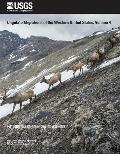
Ungulate Migrations of the Western United States, Volume 4
Document: Report (89.9 MB pdf), HTML, XML
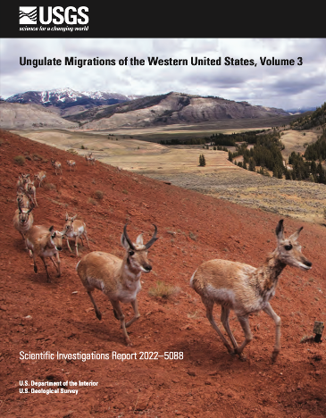
Ungulate Migrations of the Western United States, Volume 3
Document: Report (89.9 MB pdf), HTML, XML
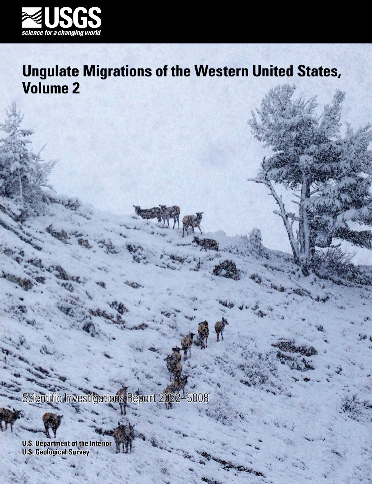
Ungulate Migrations of the Western United States, Volume 2
Document: Report (89.9 MB pdf)
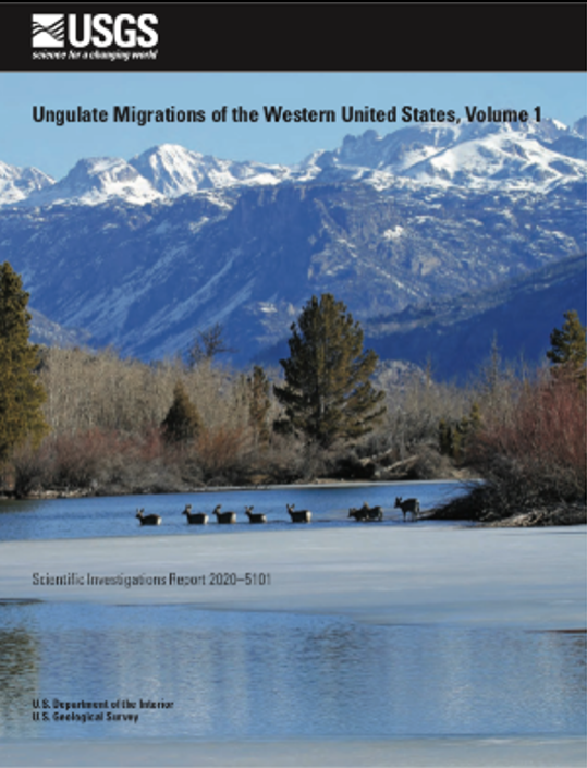
Ungulate Migrations of the Western United States, Volume 1
Document: Report (89.9 MB pdf)
Migration Mapper
Understanding and mapping where animals go is of utmost importance to wildlife conservation and management. Maps of animal movement are particularly important for efforts focused on migratory wildlife, as migratory animals rely on connected, seasonal habitats that span large landscapes. Migration Mapper™ is a free application designed for researchers, biologists, and managers, to analyze fine-scale GPS collar data collected from migratory ungulates. The app was developed by core members of the CMT and is continually maintained by the group.
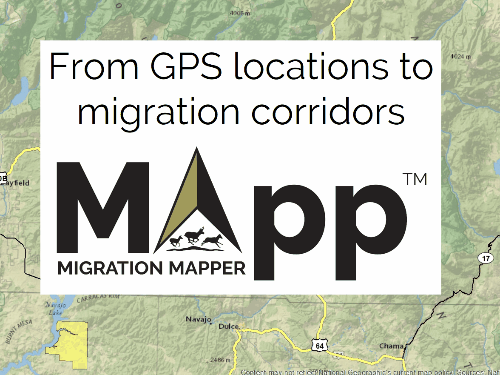
The most recent version of Migration Mapper can be downloaded here.
The Migration Mapper User Guide is located here.
There are helpful instructional videos for Migration Mapper located here.
Methods Focused Publications
Below are the core papers that inform the methods and analytics of the CMT:
- Horne, J. S., E. O. Garton, S. M. Krone, and J. S. Lewis. 2007. Analyzing animal movements using Brownian bridges. Ecology 88:2354–2363.
- Sawyer, H., M. J. Kauffman, R. M. Nielson, and J. S. Horne. 2009. Identifying and prioritizing ungulate migration routes for landscape-level conservation. Ecological Applications 19:2016–2025.
- Bunnefeld, N., L. Börger, B. van Moorter, C. M. Rolandsen, H. Dettki, E. J. Solberg, and G. Ericsson. 2011. A model-driven approach to quantify migration patterns: individual, regional and yearly differences. Journal of Animal Ecology 80:466–476.
- Merkle, J. A., J. Gage, H. Sawyer, B. Lowrey, and M. J. Kauffman. 2022. Migration Mapper: Identifying movement corridors and seasonal ranges for large-mammal conservation. Methods in Ecology and Evolution 13:1–7.
- Merkle, J. A., B. Lowrey, C. F. Wallace, L. E. Hall, L. Wilde, M. J. Kauffman, and H. Sawyer. 2023. Conserving habitat for migratory ungulates: How wide is a migration corridor? Journal of Applied Ecology 60:1763–1770.
- McKee, J. L., J. Fattebert, E. O. Aikens, J. Berg, S. Bergen, E. K. Cole, H. E. Copeland, A. B. Courtemanch, S. Dewey, M. Hurley, B. Lowrey, J. A. Merkle, A. D. Middleton, T. A. Nuñez, H. Sawyer, and M. J. Kauffman. 2024. Estimating ungulate migration corridors from sparse movement data. Ecosphere 15:e4983.
- Gelzer, E. R., J. A. Becker, S. P. H. Dwinnell, G. L. Fralick, L. E. Hall, R. C. Kaiser, M. J. Kauffman, T. N. LaSharr, K. L. Monteith, A. C. Ortega, J. E. Randall, H. Sawyer, M. Thonhoff, and J. A. Merkle. 2025. How sampling design of GPS collar deployment influences consistency of mapped migration corridors over time. Journal of Wildlife Management 89: e70009.
Partner Programs
Following the signing of SO3362, many agencies developed work plans around the effort to map ungulate migrations.
- BLM and SO3362
- WAFWA: https://wafwa.org/so3362/ as well as the Wildlife Migration and Movement Working Group. https://wafwa.org/committees-working-groups/wmmc/
- USDA: https://www.nrcs.usda.gov/programs-initiatives/working-lands-for-wildlife/usda-migratory-big-game-initiative
- Federal Highway Administration Wildlife Crossings Program: https://highways.dot.gov/federal-lands/wildlife-crossings
- NFWF: https://www.nfwf.org/programs/western-big-game-seasonal-habitat-and-migration-corridors-fund
- USFWS 2023 Report https://www.fws.gov/sites/default/files/documents/fy2023-big-game-seasonal-habitat-and-migration-corridor-report_final_02_08_2024_508.pdf
- NPS and migrations and link to the Animal Trails film. https://migrationinitiative.org/projects/animal-trails-rediscovering-grand-teton-migrations/
- NAFWS
Welcome to Western Migrations
This project is a collaboration between the following partners:
![]()
![]()
![]()
![]()
![]()
![]()
![]()
![]()